
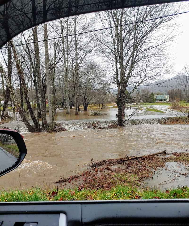
While some Clay County residents reported last week’s rainfall total from 4-6 inches or more, others were sharing videos and photos of flooded driveways and homes. On top of that, Saturday’s snow reports ranged from 4-7 inches. A flash flood watch closed schools early Thursday, Feb. 6, and they remained closed Friday. More inclement weather delayed school on Tuesday, Feb. 11.
Closing school is rarely an easy decision. Clay Schools Superintendent Dale Cole explained how those decisions are reached. “Our first priority is always the students and staff’s safety,” he said. “We work with our partners at DOT and the sheriff’s department to make the decision which is safest, but there’s no easy way to do it. Sometimes we make it the night before and we end up being wrong. Sometimes we get up at three or four in the morning, observe conditions and make the call then.”
Regarding the early dismissal last week, he said the flash flood warning was called after busses were on the roads. “By the time we were notified of that, busses were out,” he explained. “Drivers are not allowed to be on their phones so we could not contact them. We had them come to school, then made the decision to close schools because we were told conditions would continue to get worse throughout the day.
“Ultimately, it is the parent’s decision about whether it is safe to get a child to school. If the roads busses run on are safe, without standing water or ice, we will run,” Cole said. “Meanwhile, you may live on a road which has remained flooded or snow-covered. Keep your kids home, snap a picture or send a note and we will excuse them.”
During a press conference Monday, Tennessee Valley Authority River Forecast Center Senior Manager James Everett shared information about flooding while providing an update on the entire river system. With days of rainfall, followed by snow in some places, then more rain, the ground is saturated.
Even though many local streams, creeks and rivers have already been out of their banks for more than a week, Lake Chatuge is not presently at flood stage. TVA lowers the lakes seasonally to accommodate snow melt and rainfall; therefore, there is usually plenty of room for lakes to rise. Chatuge is at or near summer pool stage.
“This is really a regional flood event.” Everett said, giving the urgency of the situation. “The river system stretches from southwest Virginia to east Tennessee into the heart of Alabama and all the way out to the Ohio and Mississippi River,” he explained. “TVA operates 49 dams in seven different states in an integrated manner. All of the dams are connected so the decisions we make at one dam affect other locations. We use tributary dams to store water, which is why we draw them down in the fall and be ready for events like what we are experiencing.”
“As of last week, our February rainfall is already 300 to 400 percent of normal rainfall for month-to-date,” he said. “Year to date, we are at almost 11 inches of rain valley-wide, which is almost 200 percent of normal. Very impressive rainfall last week. We are expecting rainfall in some form or fashion almost every day this week. Generally, we are expecting an additional three to five inches of rain, but some isolated areas could have six to seven inches of rain.”
Everett continued, “Rainfall on top of already saturated ground will produce heavy runoff into our reservoirs.” Then he explained how the water is managed. “We use tributary dams in some places like Cherokee, Fontana, Hiwassee, Norris and others,” he said. “These large tributary projects are tributaries to the Tennessee River and these large dams are used to store water. We have begun reducing outflows from those tributaries to continue storing water, as we did last week. We will continue storing water in the lakes to help alleviate flooding immediately below those dams, as well as provide reduced flows into the mainstem Tennessee River. As a result of reducing those flows, we expect tributary lake levels to continue rising.”
What does this mean for Lake Chatuge and Lake Nottely? “We will use those dams to store water to help alleviate downstream flooding,” he said. “On the backend of this event, when we do get a break in this rainfall, we will be releasing high amounts from these tributary dams to reduce overflow.”
Many of the system’s dams are generating or releasing water over the tops as well as releasing water below the dam, called sluicing. The Tennessee River at Knoxville was below flood stage while it was near its 30 feet flood stage in Chattanooga where it was 27 feet Monday. Some areas of Alabama and Tennessee are above flood stage and may approach moderate flood stage, Everett said. “In our Kentucky Dam, we will continue to coordinate releases due to flooding on the Ohio and Mississippi Rivers,” he said. “We are looking at every single dam and coming up with an operating strategy that puts us in the best position possible with the rainfall outlets we have.”
Everett advised anyone living, working or camping near one of the lakes or tributaries, to check the elevations and forecasts regularly before during and after rain events. “When we look at these forecasts, it includes predicted amounts,” he said. “If it comes in heavier or lighter than the forecast, the forecasted elevations will change throughout the week. Don’t just check on the front end of an event.”
A free TVA Lake Info app is available for those who want to follow TVA’s lake monitoring, along with outflow amounts at certain times. The information and forecast updates four times a day. Lake Chatuge or another reservoir may be chosen as favorite. Updated forecasts are also available at TVA.com or by following TVA on Facebook or Twitter.
At press time, more rain was in the local forecast for Thursday, Feb. 13, followed by below freezing temperatures at night. A reprieve from the rain should last until early next week.