
Spring in the mountains started a little less wet than usual this year with rainfall mostly non-existent for several weeks. In response, a burn ban was placed by the U.S. Department of Agriculture’s Forest Service as well as local fire departments, while brush fires popped up around the area. The N.C. Forest Service had issued a statewide burn ban on March 28 due to “hazardous forest fire conditions.” While gardeners may be questioning what this year’s crops may look like with dry conditions, some areas of the region had a good soaking rain the first week of May.
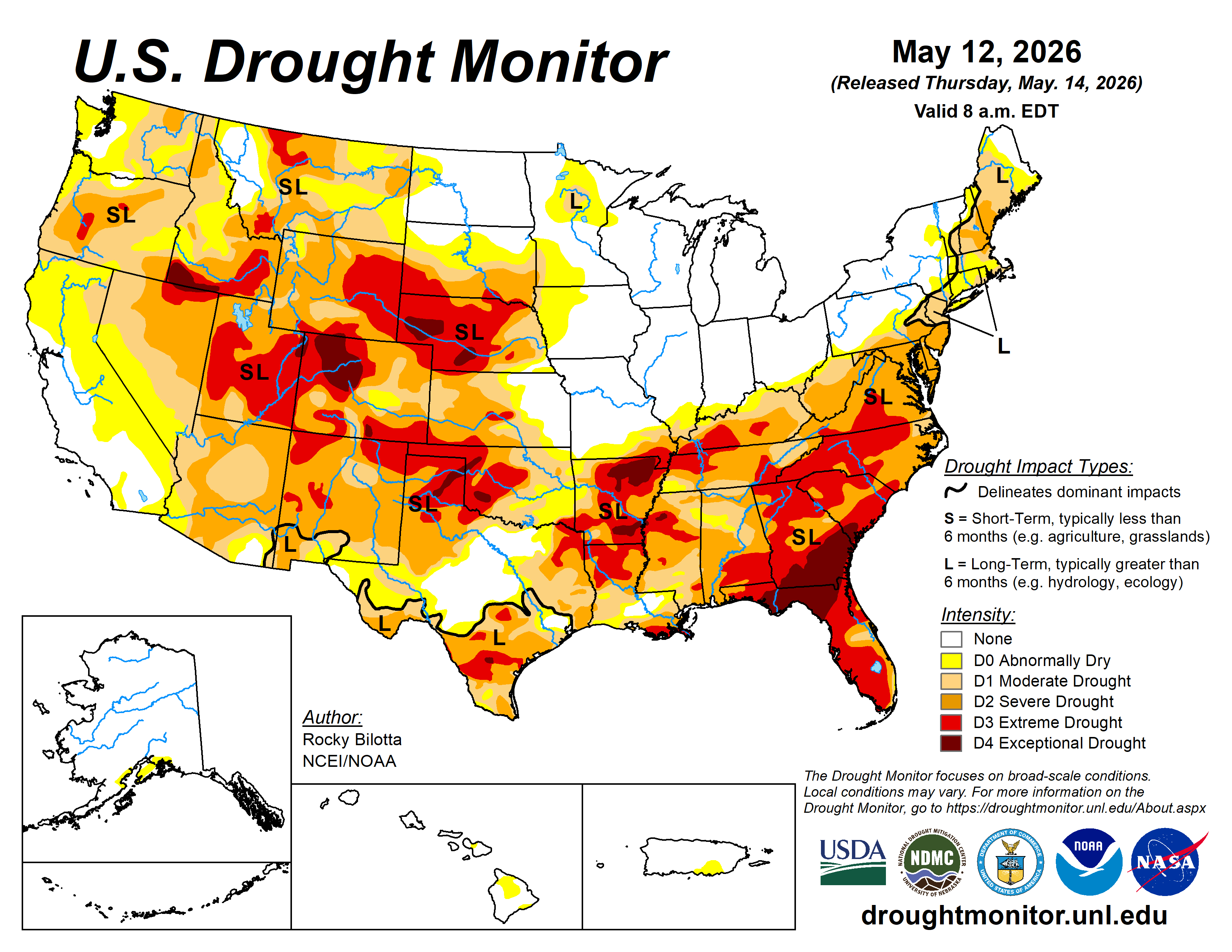
After a couple of rainfalls, state fire officials lifted the burn ban in 81 North Carolina counties, including Clay and other far western N.C. counties. The ban was completely lifted around the state a few days later. Despite some rainfall, the U.S. Drought Monitor kept Clay County and other local counties in the extreme drought category. Long term drought sometimes leaves lingering problems behind, even after the drought has ended. MountainTrue Southwestern Regional Director Callie Moore is surprised the U.S. Drought Monitor kept far western North Carolina labeled as extreme drought. According to Moore, who lives in Clay County, residents are seeing some impacts. “Reservoir levels and filling of the lake are being impacted by the drought,” she said. “TVA is required to provide a minimum flow to the river below the dam to maintain healthy populations of fish and other aquatic life. When the amount coming in is roughly the same as that minimum flow, the reservoir doesn't fill like it normally would.” Moore said this area has not yet been in long term drought. “The biggest impacts of a long-term drought are a lack of groundwater recharge and the potential for more concentrated water pollution,” Moore explained. “Drought degrades water quality by reducing dilution capacity, which leads to higher concentrations of contaminants, lower dissolved oxygen and increased water temperatures. Higher nutrient levels coupled with warmer temperatures can lead to algae blooms during drought, especially in lakes. Extended drought can also significantly impact groundwater supplies by reducing natural recharge, which can lead to depleted wells.” Following the end of the burn ban for 81 counties, the U.S. Department of Agriculture’s Forest Service also lifted fire restrictions across North Carolina’s four national forests. A press release reminded folks to use caution, even though the ban was lifted because there are still underlying dry conditions. “Recent widespread rainfall helped reduce the overall fire danger across much of the state, the press release said. “Forest visitors will be able to once again build campfires and use camp stoves and fire rings.” These safety tips were published for campfires but are appropriate for other fires, too.
• Make sure your campfire is a safe distance from your tent or anything that can ignite unexpectedly.
• Use rocks to create a fire ring in the center of a large, clear area.
• Use the Drown-Stir-Drown-Feel method to put out your campfire safely.
• For more information, check out Smokey Bear’s Campfire Safety webpage. Wildfire updates are available on the Facebook page for National Forests in North Carolina, found at: www.facebook.com/nfsnc or visit: www.fs.usda.gov/r08/northcarolina. Until there is substantial rain, fire danger is high and most local counties have their own burn guidelines. For many, this includes restrictions about how close fires may be built to structures. To reach the office of Clay County’s Fire Marshall, call: (828) 389-0274.
Moore reminded, “The large amount of rain that recently fell across our area prevented a lot of these long-term impacts.” Visit: MountainTrue.org for more information about clean water, forests and healthy communities. Some much needed rain is in the forecast this week, according to Weather Underground, The Weather Channel and North Carolina Weather Authority. Starting Thursday and through Memorial Day weekend, there is a chance for rain and even some thunderstorms. Highs should be in the low to mid 70’s, while lows will be in the upper 50s to 60s at night.