
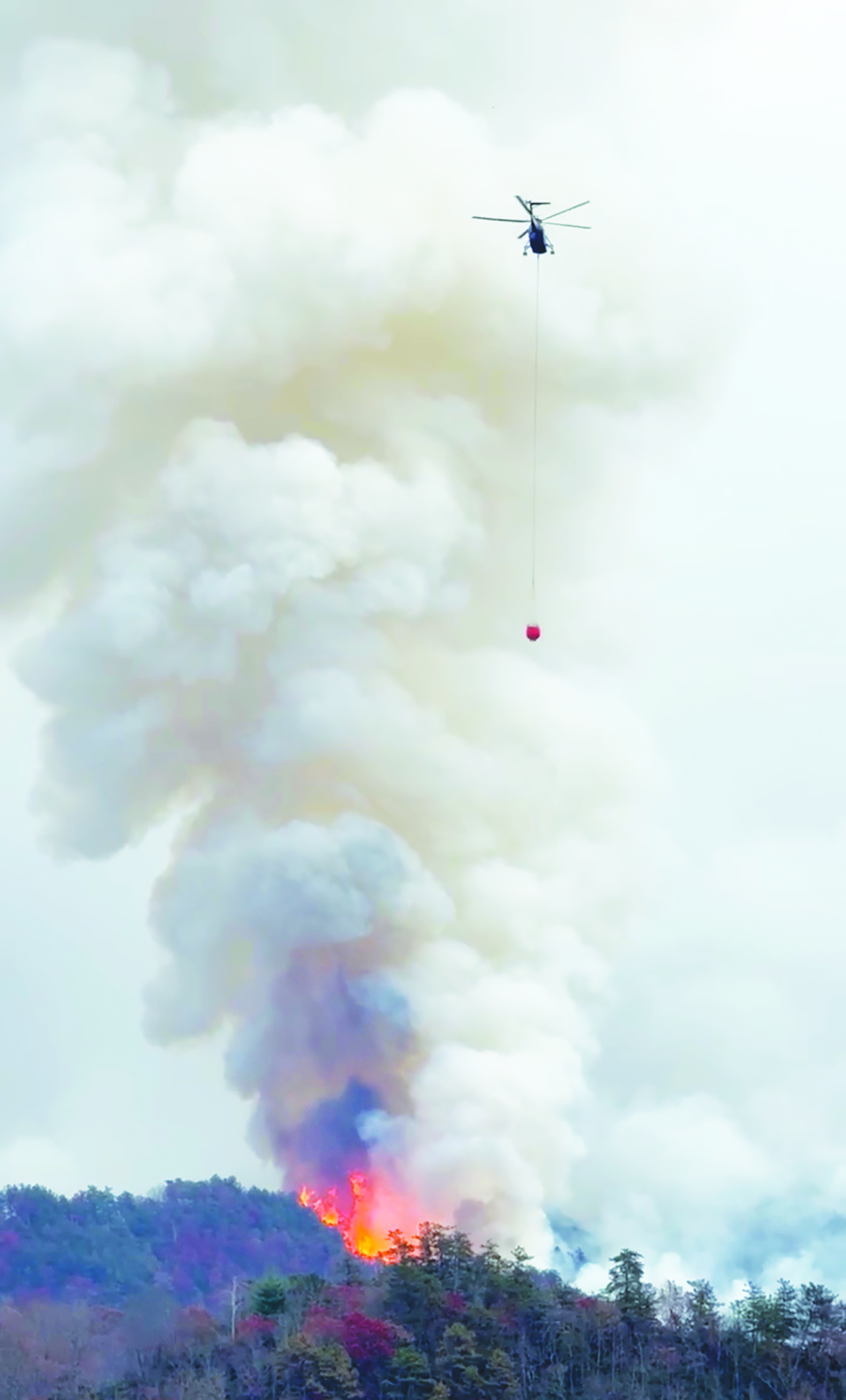
Photo by Randy Foster/editor@cherokeescout.com A heavy-lift helicopter prepares to drop water from a bucket on a hot spot in the Collett Ridge Fire east of Pisgah Road on Thursday.
By Randy Foster
editor@cherokeescout.com
Following a welcomed wet and dreary weekend, firefighters braced for more fire-friendly weather Monday as the Collett Ridge Fire entered its third week.
Four 20-person hand crews were busy Monday bolstering existing containment lines, such as Forest Service roads, old logging roads and creeks while bulldozers carved new containment lines to keep the 5,335-acre fire in check.
The good news is that 71 percent of the blaze was safe behind containment lines as of Monday morning. Disconcerting news was the return of drier, warmer weather later Monday and movement of the fire to the west and southwest.
In all, 275 personnel were assigned to the blaze as of Monday morning. They included the 80 crew members on the ground, 19 fire engines, one bulldozer and one water tender and two helicopters.
The incident command post was moved from Grace Community Church to Erlanger Western Carolina Hospital in Peachtree over the weekend. Additional personnel were located at that site, providing operations and logistics support for ground and air crews.
“Weather continued to play an important role in assisting firefighters in increasing containment on the fire yesterday,” according to a release issued Monday morning. “A drone was used to conduct aerial reconnaissance to identify heat signatures within the fire area: heat sources from larger smoldering fuels, such as snags, stumps and dead-and-down trees, were identified well inside the fire perimeter.”
Hand line work has been completed around the perimeter of the fire area and crews will continue to improve containment lines and perform mop-up operations, such as extinguishing any lingering hot spots, as needed, according to the Tuesday morning update. A helicopter made multiple water drops on Monday working to put out hot spots observed west of Collett Ridge.
Firefighters will reduce forest fuels around residences in the area between Genesis Lane and Bear Dog Drive as a protection measure, with plans to continue residential fire fuels reduction work south of Pisgah Road to the McClelland Creek Road and Snider Road area and along the south side of Junaluska Road toward Junaluska Baptist Church.
Fair weather was expected Tuesday as dry high pressure settles over the region. There will be a layer of high-level cloudiness that will filter the sunshine, resulting in partial-to-full shading at times. The air mass is very dry, so the humidity may still bottom out in the 20 percent range. Humidity recovery along the ridges Tuesday night was expected to be poor. Winds will favor a normal up-slope, up-valley flow during the day and down-slope, down-valley at night. Ridgetop winds are expected to be variable.
Weather and fire behavior
Surface fuels have become dry in the top layers, allowing limited fire spread potential where a heat source is present, fire officials said.
“Until sufficient precipitation occurs, expect areas of isolated smoldering, primarily in heavy woody fuels such as log ends and snags,” according to a release. “Heavy fuel concentrations will retain heat and serve as future heat sources. The primary fire behavior characteristic for the day continues to be isolated smoldering. Smoldering leaf litter may kindle to flame with a little wind and/or sunshine and burning snags may fall into fresh, dry fuels.
Burn bans were still in place due to increased fire risk. The N.C. Forest Service has issued a ban on all open burning until further notice in several counties in western North Carolina. For details, visit: www.ncforestservice.gov/fire_control/sit_report.htm.
The U.S. Forest Service has implemented fire restrictions across the Pisgah and Nantahala national forests. To view the closure order, visit: www.fs.usda.gov/alerts/nfsnc/alerts-notices.
A temporary flight restriction is in place over the Collett Ridge Fire area.
“If you fly, we can’t,” according to a release. “Aircraft or drone intrusions into the restricted airspace endangers aircrews conducting fire operations and aerial resources are grounded for safety. This unnecessarily places aircrews and ground fire crews at risk in a dynamic and dangerous fire environment.”
Closures
For public and firefighter safety the following road and area closures are in effect due to increased fire activity and suppression operations in the area from Big Stamp east to Shinbone Ridge to Signal Bald and a road closure is in effect from the intersection of Little Fires Creek Road, 340B and Fires Creek Road, 340.
The Rim Trail is temporarily closed for about 7 miles from Big Stamp to Shinbone.